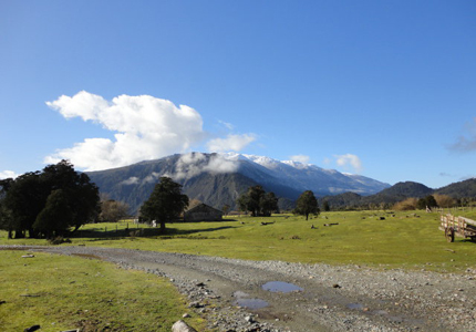
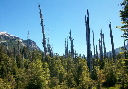
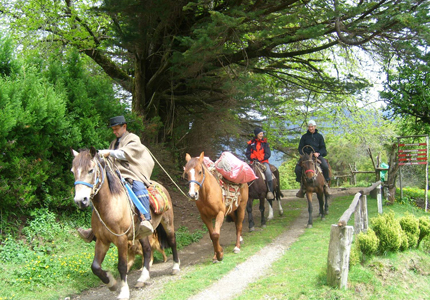
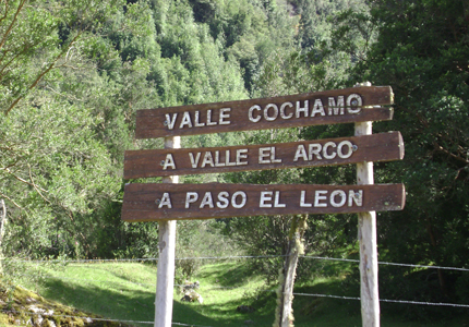
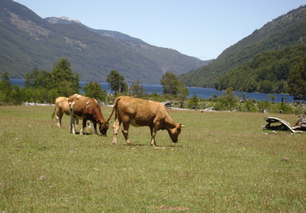
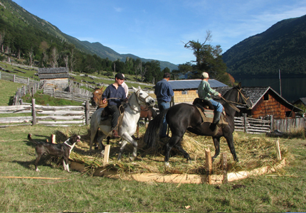
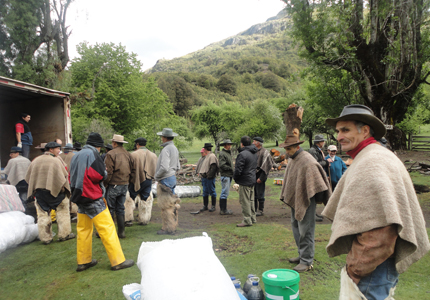
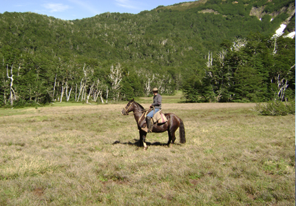
Este recorrido sigue la senda de los primero colonos y comerciantes de ganado. Pasa por una de las áreas más bellas y ecológicamente significante del sur de Chile. Se inicia en el pueblo de Cochamó, donde puede comprar provisiones, contratar guía y arrendar caballos. Debido a las características del recorrido, es casi indispensable contar con un guía local y por lo menos un caballo de carga. El recorrido permite conocer y apreciar una gran diversidad de ecosistema, fauna y flora, lagunas altos andinas así como ríos con aguas cristalinas y campos ganaderos de montaña. Atractivos del recorrido son entre otros "La Junta" (bosque nativo original), "El Arco" (Alerzales) y Lago Vidal Gormaz (belleza natural y sentamiento humano). Por la larga presencia de nieve en las partes superiores de los tramos, se recomienda realizar el recorrido en verano a partir de diciembre. Sin embargo también en esta época el tramo hasta lago Vidal Gormaz es difícil y exige muy buen estado físico para quienes desean caminar por que existen muchas partes pantanosas y de mucho barro. Además la cruzada de los varios ríos puede causar problemas en época con mucho agua hasta que hay que contar con un retraso de un día en caso que no se puede cruzar uno de los ríos. Es importante llevar carpas, ropa de agua y comida para lo menos tres días, debido a que en la primera etapa de la ruta no existen asentamientos humanos.
This route follows a trail of early settlements and cattle trade. It passes through some of the most beautiful, ecologically significant areas of southern Chile. You may begin in the village of Cochamó where one can buy foodstuffs, rent horses and hire a guide. Give the uncertainty of natural conditions along the way, a local guide and horses, at least for luggage, are highly recommended. Along this route you will be able to appreciate a great diversity of ecosystems, fauna, and flora as well as high Andean lakes, crystalline rivers, and mountain cattle farms. The highlights of the tour are "La Junta" with its intact native forest, "Vidal Gormaz" region with its natural beauty and quaint human settlements. Because there is often snow in the upper parts of the trail, it is recommended that you hike during the summer (December onwards). Nevertheless, even in summer, the route to Lake Vidal Gormaz can be both muddy and challenging. Those who want to walk should be in good physical condition. When water levels are high crossing the various rivers can also pose a problem. It is therefore necessary to allow for an extra day in case of crossing difficulties. Since there are no settlements on the first segment of the route it is important to bring tents, waterproof clothing and enough food for at least the first 3 days. Information upon arrive in Cochamó: coordination office, municipal Cochamó near the village's entrance.
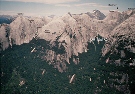
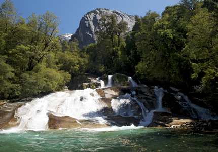
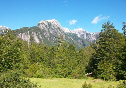
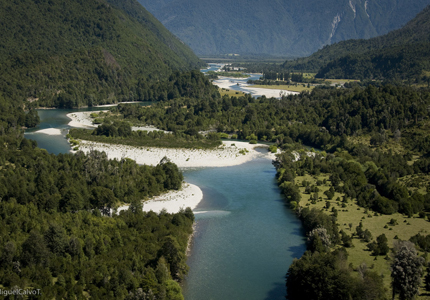
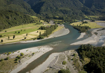
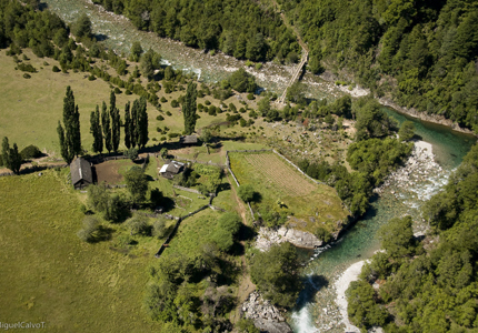
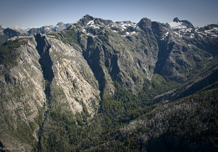
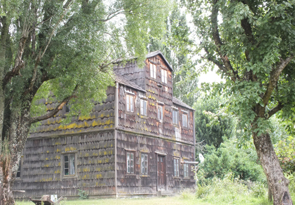
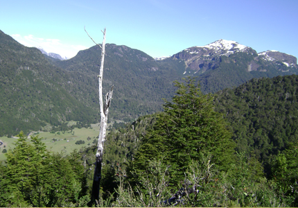
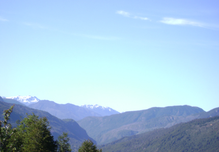
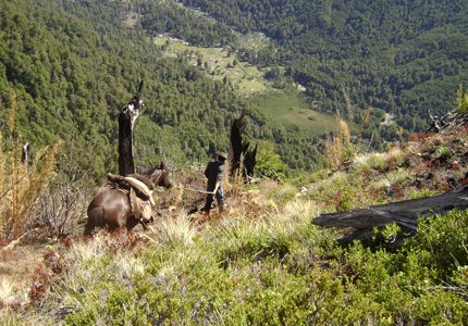
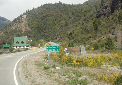
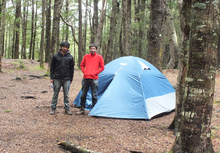
El tramo comienza en el puente sobre el Río Cochamó. Sube a la rivera norte del río. Los primeros 7 km. Son de camino de ripio que después se convierten en camino de tierra y mas allá en el sendero de tierra bien reconocido hasta de llegar a la junta. Para evitar el camino de ripio también existe la posibilidad de seguir la rivera sur del río Cochamó y cruzar este mas arriba en el vado. En este caso tiene que pedir permiso para cruzar unos campos particulares. Llegando a la Junta después de haber pasado una angostura en el Valle del río Cochamó, se abre una vista impresionante hacia los altos cerros graníticos con sus espectaculares formas (cerro Trinidad). En este sector encuentras buenas posibilidades de acampar. El tramo entre La Junta y el arco es de muy alta diversidad y belleza escénica. Subiendo lentamente el valle de río Cochamó desde La Junta hay que cruzar los ríos La Junta, traidor Valverde y finalmente se llega a El Arco donde se cruza el río del mismo nombre. Como ya lo indica su nombre, este corresponde arco de roca con un alerce arriba, que cruza un pequeño saldo de agua se recomienda hacer este tramo en un día y quedarse en el refugio rustico en El Arco poco arriba del río a mano derecha en una pradera, en el tramo siguiente hasta lago Vidal Gormaz se presentan escasas posibilidades de acampar. En los boques alrededor de El Arco existen ejemplares gigantescos de alerce, hasta milenario. Los amates de la naturaleza quedaran muy satisfechos en esta parte de la caminata en el bosque. La orientación en el tramo desde El Arco hasta lago Vidal Gormaz en general es difícil por lo que se recomienda ir acompañado por un guía local. Se pasa por uno de los paisajes boscosos más impresionante en todo el recorrido. En el transcurso de este tramo se cruzan algunos arroyos y ríos menores. El camino sigue subiendo hacia el paso entre El Arco y el Lago Vidal Gormaz y pasa por una preciosa laguna cordillerana al otro lado del paso. El sendero bordea la laguna por su costado sur. Pasa por un espectacular bosque virgen formado por tepa. Mañìo hembra y coigue. El sendero baja y saliendo del bosque llega a lago Vidal Gormaz donde se ofrecen varias posibilidades de acampar.
This route begins on the Cochamó rive bridge and continues up the river's north bank. The first 7 km of the road is gravel, which later becomes dirt. Finally the order ends in an easily identifiable trail to la junta. In order to avoid the gravel road one can follow the river's south bank and cross further upstream at a ford. This option requires that you ask permission to cross private land. The height of the trail ranges from a few to 100 meters above the river. After passing through a narrow in the Cochamó River Valley and arriving in La Junta, you will enjoy spectacular vistas of the carved granite cliffs. Camping in possible in this sector. The route from La Junta to Arco is rich in both diversity and breathtaking scenery. As you gradually climb the Rio Cochamó Valley from La Junta, you will cross various rivers: La Junta, Traidor, Valverde and finally in El Arco, a river of the same name. As the name indicates, El Arco features an arc of natural rock that crosses a small waterfall with a single Alerce tree on top. We recommend you hike this route in one day and spend the night in Arco's rustic refuge. The refuge is located just above the Arco Rive in a meadow to the right. On the following stretch to Lake Vidal Gormaz places to camp are scarce if the necessity arises. In the forests around El Arco you will encounter examples of giant Alerce trees, some as many as 1000 years old. Nature lovers will find this hike through the forest truly enjoyable. Orientation yourself on the route from El Arco to lake Vidal Gormaz is difficult. We recommend that a local guide accompany you. The trail passes through one of the most impressive forested landscapes in all the tour. Along the length of this stretch you will cross streams and small rivers as the road continues climbing towards the El Arco Lake Vidal Gormaz pass. On the other side of the pass you will find a beautiful mountain lake which the trail also passes through spectacular virgin forests composed of Tepa, Manio and Coigue and then descend, leaving the forest behind. You then come to the typical cattle ranching lands of southern Chile and beautiful Lake Vidal Gormaz where you may cam.
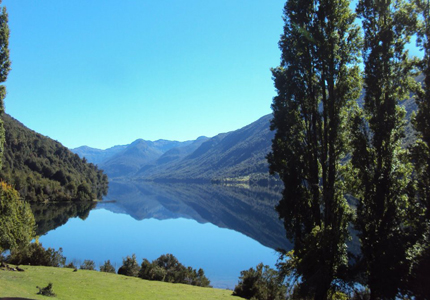
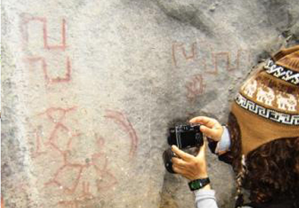
El camino principal sigue a la rivera accidental del lago Vidal Gormaz. La senda pasa a veces directamente por la orilla del lago con playas pedregosas, después sube y serpentea muy arriba de la orilla del lago Vidal Gormaz abriéndose a veces para mostrar espectaculares vistas de este hermoso lago. Llegando al extremo sur del lago el camino sigue y llega al sector de Torrentoso. En este sector se pueden visitar los petroglifos cuyo origen aún esta definido. Estos muestran figuras geométricas y abstractas de distintos tamaños en color rojo, pintadas sobre de rocas graníticas. Para su ubicación exacta se recomienda preguntar a los lugareños. Después de pasar por el sector Torrentoso existen dos opciones; bajar por el río manso para llegar al lago Tagua Tagua o seguir al noreste hasta El León, caminando aguas arriba por la rivera norte del río Manso. En esta ultima opción, el sendero sube y baja en forma pronunciada durante todo el trayecto, y solo de vez en cuando se divisa el río Manso, con sus aguas color turquesa, encajonado muy abajo del camino. Llegando al León se cruza el río Los Leones por una pasarela para seguir hacia el camino que va por Argentina. Existen varias posibilidades de hacer excursiones en el sector El león, como a León Alto, laguna Oscura y laguna Brava.
The main route follows the western shore of Lake Vidal Gormaz. The path follows along the lake's pebble beaches and then climbs upwards, snaking high above the shore, offering occasional views of the spectacular lake. Upon arriving at the lake's southernmost point, follow the trail and then in the Torrentoso sector, take the wooden bridge. In this area you can visit petroglyphs of unknown origin. There abstract red geometric figure of different size are painted directly on the granite rock. Consult the locals from their exact location. After the Torrentoso sector there are two options: down the Manso River and then on to lake Tagua Tagua (as described later on) or up the Manso River to the northeast towards el Leòn. During the whole length of the hike, the path climbs and falls noticeably along the north side of the Rio Manso valley. You may catch occasional glimpses of the Manso River's turquoise waters far below the Los Leones rive on a small footbridge and then continue on towards Argentina. There are various possible excursions in the El Leon alto and lakes Oscura and Brava.
También existe la posibilidad de llegar directamente a El león por el borde noreste del lago Vidal Gormaz subiendo los "Cerros quemados" para seguir el costado de las cumbres altas de los cerros hasta el portezuelo fischer. Desde allí el sendero sigue rumbo sudeste hasta la parte más alta de este cordón montañoso, lugar con excelente vista hacia el valle Los Leones. Desde aquí se baja a la laguna Brava, donde existe un lugar para acampar en el costado sudeste. Se llega al camino principal que va hacia el valle del Río Leones. Durante toda la bajada se ofrece una vista espectacular hacia este valle poblado. Mas abajo se cuza el río los leones hacia su costa Este a través de un pequeño puente de troncos. Desde allí el excursionista sigue río abajo sin cruzar el río otra vez hasta llegar al poblado El León.
It is also possible to go directly to El Leon. Follow the northeast border of Lake Vidal Gormaz up to ceros Quemados and then along the flank of the hills to Portezuelo Fischer. From there the trail continues to the southeast along the highest part of this mountainous chain. And offers excellent views of Los Leones Valley. It then descends to Brava Lake, where you can find a decent sport for camping on the southeast shore. The main route to the Leones Valley offers beautiful views of this inhabited valley on the way down. Further on you may cross to the east bank of Los Leones River on a small log bridge and continue downstream without crossing again until El Leon.
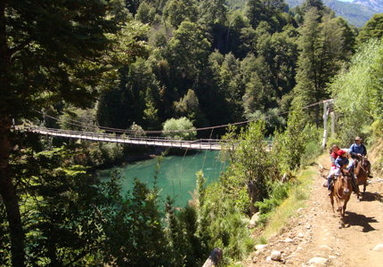
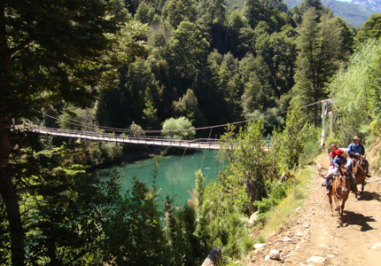
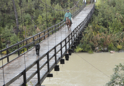
Existe la posibilidad de seguir desde El León hasta Argentina en una caminata de un día. Para cruzar la frontera es necesario pasar por carabineros de Chile. El sendero hacia Argentina va bordeando el río manso por su costado Norte. Poco después del León se cruza la frontera chilena - argentina. El sendero sigue al mismo lado del Río Manso que se llega a gendarmería en Argentina. Aquí se cruza el Manso por un puente colgante y es posible seguir a pie o conseguir transporte para llegar a villa Villegas por un camino de ripio. Villa Villegas se toma el bus hasta El Bolsón y Lago Puelo y se puede volver a entrar a Chile por el paso el "Bolsón", continuando su excursión río abajo por el valle Puelo. Hacia el océano pacifico.
It is to do a day hike from El Leon to Argentina. Exist stamp you passport at the "Retén de carabineros" or police outpost in El Leon. The trail to Argentina borders the north bank of the Manso River. Shortly after leaving El Leon, you will cross the Chilean- Argentina border. The trail continues along the north bank until it reaches the argentine police outpost. Here you can cross the Manso River on a hanging bridge and hire transportation or walk the gravel road to villa Villegas you can take a bus to Bolsòn and Puelo Lake. You can then re-enter Chile through the El Bolsòn pass, and continue you excursion down river in the Puelo valley towards the Pacific Ocean.

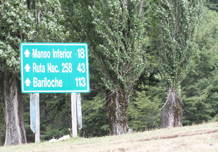
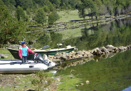
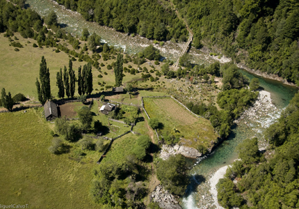
Para seguir aguas abajo del río Manso hay que volver por el mismo camino hasta el sector de Torrentoso como ya fue descrito en el tramo Torrentoso - El León. Llegando al sector torrentoso hay que cruzar el río torrentoso y subir el camino que se dirige a la pista de aterrizaje. Se cruza y entra al otro lado en el bosque. A partir de ahí el sendero en altura de costado oeste del río Manso hasta llegar a la confluencia del río Manso con el río Frío. Llega al sector del río Steffen donde pasa por algunas casas que ofrece lugar para acampar. Más adelante baja al río Steffen. De allí el camino sigue bordeando el río Manso y se pone mas ancho y fácil de seguir se acerca al sector de El Manso. Al llegar a este sector el camino pasa por la pista de aterrizaje y el supermercado, para encontrarse con el nuevo camino de ripio, desde donde se puede llegar fácilmente al lago Tagua Tagua que se cruza en trasbordador o lancha particular para seguir el pueblo de Río Puelo. En el Manso también tiene la opción de seguir con su excursión por el valle Puelo, subiendo hacia lago puelo en Argentina como es descrito en el circuito 2.
To follow the Manso River downward, use the trail to Torrentoso as previously described in the Torrentoso- El Leon Route. Upon arriving at the Torrentoso sector, you cross the Torrentoso River by bridge and continue up the trail to the trail to the landing strip. Cross the strip to the forest on the other side. The trail continue in the heights of the Manso River's west bank to the point where the Manso River's west bank to the point where the Manso and Frio rivers join. In the Steffen River sector you will find houses. Shortly thereafter, walk downhill to the Steffen River and cross the bridge. This section of the trail is full of steep hills before the final descent to Manso River. Continue as the trail widens and become easier to follow near the El Manso sector. The route borders the Manso River until it reaches the landing strip and supermarket. Local near the supermarket is the new gravel road which conveniently leads to Lake Tagua Tagua. You can cross the lake by ferry or private boat and continue your journey on to the town of Rio Puelo. In El Manso you also have the option of continuing your excursion and ascending the Puelo Valley towards Argentina's Puelo Lake as previously described.