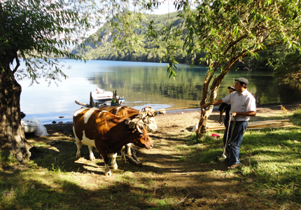
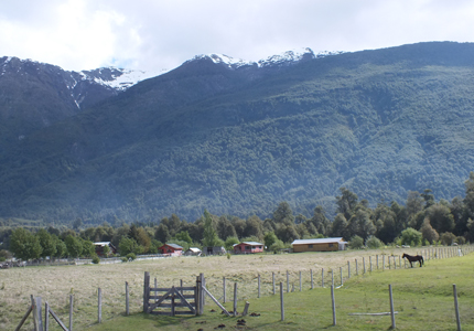
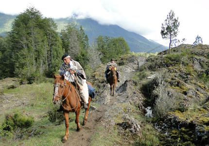
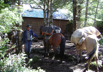
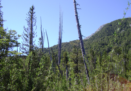
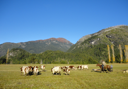
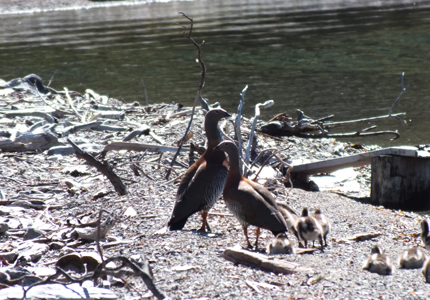
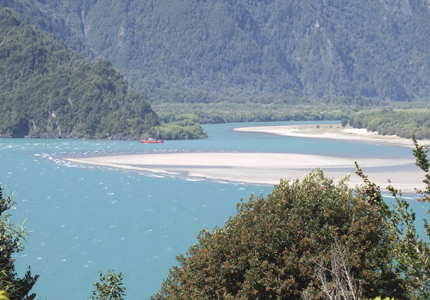
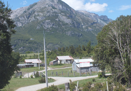
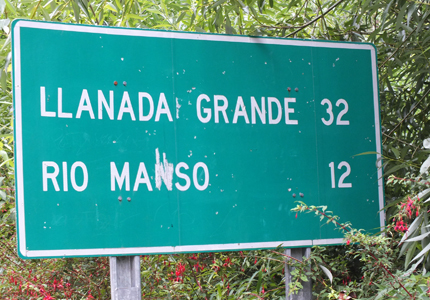
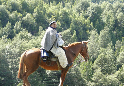
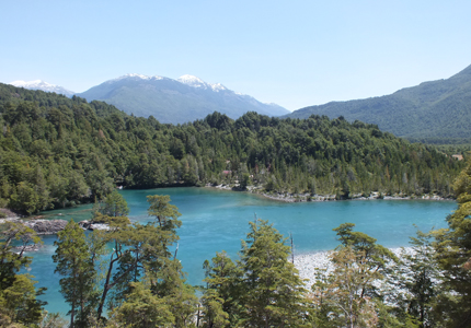
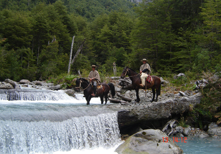
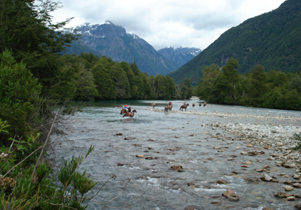
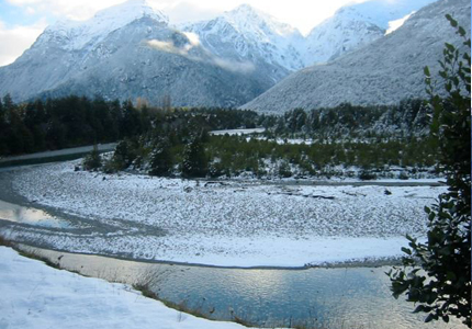
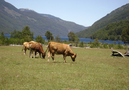
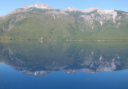
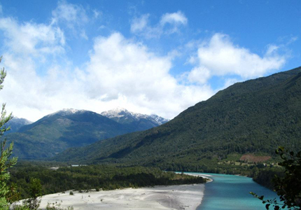
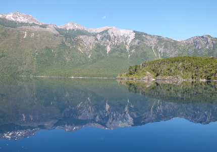
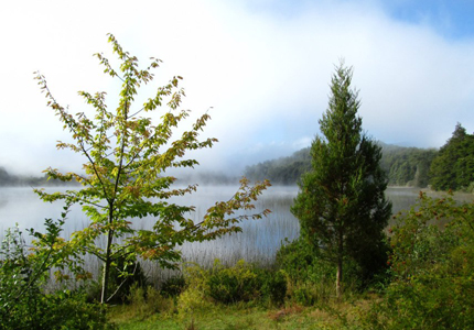
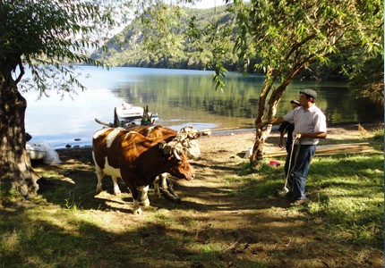
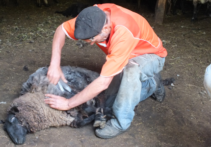
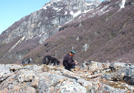
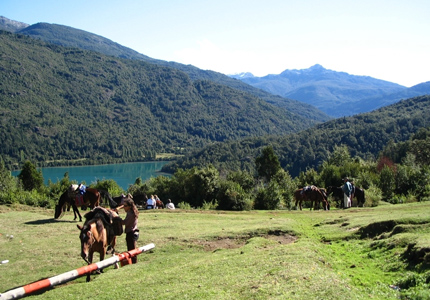
El valle de Río Puelo se puede recorrer desde la capital comunal Río Puelo en el océano pacifico (Estuario Reloncaví hasta Argentina (lago Puelo/Bolsón) o a al revés. Es un valle de origen glaciar, marcado por el caudaloso Río Puelo, rodeado por cordilleras y abundante en cascadas, lago y lagunas. Se encuentran algunas especies nativas ausentes o poco comunes en el resto del país, entre estas mereces una mención especial los alerces, huemules, pudues, pumas y cóndores. También es posible encontrar una especie exótica proveniente de la Argentina, se trata de jabalí, animales en que la zona se mezcla con los porcinos domésticos. En cuanto a las rutas para recorrer los distintos sectores del valle, cabe señalar que por la existencia de numerosos senderos es fácil perder la ruta por lo que se recomienda contratar algún guía de la zona. Los colonos que se ofrecen como guía también disponen de caballos para arrendar, ya sea para cabalgatas o transportar el equipaje. En todo el sector es posible encontrar pequeños asentamientos humanos en donde se puede conseguir algunos víveres y un lugar para acampar. Para conseguir hospedaje y víveres solo se pueden ir hasta Llanada Grande y Segundo Corral.
Eco-tourism router in the Rio Puelo valley the Rio Puelo valley can be accessed and crossed via Puelo on the coast of the pacific ocean (reloncaví estuary) at the Argentina border (or vice versa). This glacial valley. Features the Puelo River with its abundant waters. The are is surrounded by mountains, sprinkled with waterfalls, lakes, and lagoons. In this part of the country there are rare native species of plants and animals. Most of these species are in danger of extinction, such as Alerce, huemul, pudues, puma, and condor. You may also encounter an "exotic" animal that crossed over from Argentina, the javalìna, a wild boar that mixes with the domestic pigs the region. In terms of the different routes for exploring the distinct sectors of the valley, it is important to point out that, due to the many existing trails, you can easily loose orientation. It is therefore recommended that you hire a local guide. Various settlers offer guiding service as well as horses for horseback riding or luggage transport. Throughout the entire valley you will find small settlements where you can buy food an find a place for camping. For a greater variety of food and lodging you'll need to reach Llanada Grande or Segundo Corral.
Se cruza el lago Tagua- Tagua y se sube hasta la desembocadura del Río Mallin, ahí hay un sendero que llega al Río Traidor. Se puede pedir el cruze de este río en bote. El mismo sendero continua al lado poniente del Río Puelo hasta el sector "Santo Domingo". Ahí se puede cruzar el puelo en lancha de los pobladores, para seguir un camino vecinal por el mismo lado del río hasta llegar a balseo en el sector "La Vega". Cruzando el puelo desde el balseo se puede continuar hasta Llanada Grande, o también hacia los otros sectores. El tramo descrito es una alternativa viable para evitar el camino ripiado, pero solamente se puede hacer con guía local.
Cross lake Tagua Tagua and walk to the mouth of the Mallìn River where the trail to the Traidor River begind. There you may hire a boat to take you across the rive. The trail continues on the western side of the Puelo towards the Santo Domingo sector. After crossing the Puelo in one of the local boats, take the main road to Llanada Grande. You may also choose to take the communal road located on the same bank to the river crossing UN la Vega. From there you can continue on to Llanada Grande or elsewhere. The route described is a viable alternative for avoiding the gravel road, but can only be done with the help of a local guide.
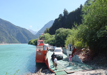

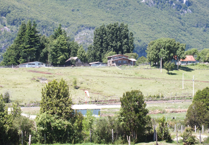
Tramo que conecta el lago Tagua-Tagua con Llanada Grande por un camino de ripio (aprox.32 Km.) para cruzar el hermoso lago Tagua Tagua existe un trasbordador o varias lanchas pequeñas de dueños particulares. Este camino cruza al río manso por un puente. A continuación subirá al sector "Los Guindos", para después continuar al sector "Santo Domingo". Poco después se llega al puente que cruza al río negro y por último el camino entra al valle de río alerce para llegar a Llanada Grande, aldea Principal del sector. Este nuevo camino ripiado será apto para recorrido en bicicleta, mientras que para cabalgatas y caminatas el valle del puelo ofrece mejores opciones.
This route is relatively new with contruction being completed in 2001.This gravel road connects Llanada Grande with lake Tagua Tagua where both ferry and privately owned boats are available for crossing. The road then continues, crossing the Manso River, climbing towards the Los Guindos sector and then on to the Santo Domingo sector. After arriving at the Negro River Bridge, the road enters the Rio Alerce Valley and leads to Llanada Grande, the main village in the sector. This new gravel road may serve for bicycle trips some time in the future, while there are much better options for hiking and horseback riding throughout the Puelo valley.
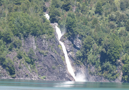
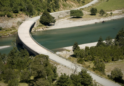
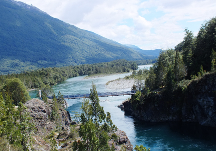
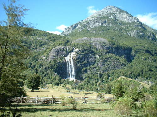
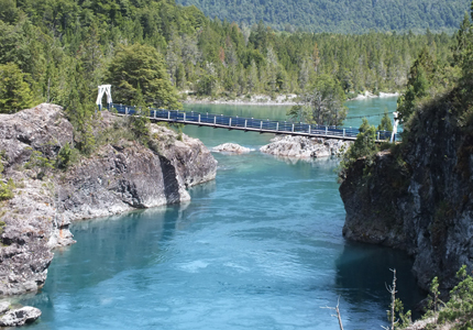
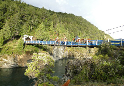
Para este tramo existen diferentes alternativas. Todas comienzan por el camino principal que pasa por el lago totoral y cruza aprox. En el Km. 4,5 su afluente llamado Rio Mapocho (hasta este tramo llega el camino de ripio). Una alternativa es seguir por el lago blanco y el Rio Las Cataratas (con salto de agua) hasta llegar a la pasarela que atraviesa el Puelo (Distancia Llanada Grande-Primer Corral aprox. 20 km.). Otra alternativa pasa por el balseo del Puelo (NO CRUZAR EL RÍO) y en continuación por el Lago Verde. Después de pasar por el lago, el camino baja con dirección al sur para llegar al Rio las cataratas. Poco después se llega a la pasarela del puelo (Llanada Grande a Primer Corral por este tramo: aprox. 22 km.) La tercera alternativa es cruzar el Puelo por el balseo y seguir por su ribera poniente. Cabe destacar que para llegar a Primer Corral, es necesario cruzar el Rio Ventisquero a unos kilómetros aguas arriba (Llanada Grande por este tramo: aprox. 20 km.).
There are various options on this route. All routes begin with the main trail that passes Totoral Lake and the Mapocho River, 4.5 kilometers thereafter. You can follow the Blanco River (whit rapids), to the wooden bridge that crosses the Puelo. (The distance from Llanada Grande to primer corral is about 20 km.).Another alternative is to pass the Puelo River crossing (DO NOT CROSS THE RIVER) and continue on to Verde Lake. After the lake, the trail descends southward towards. Las Cataratas River which you can cross by bridge. Shortly after crossing you will arrive at the Puelo Bridge in Primer Corral. (This route from Llanada Grande to Primer Corral is about 20 km.).
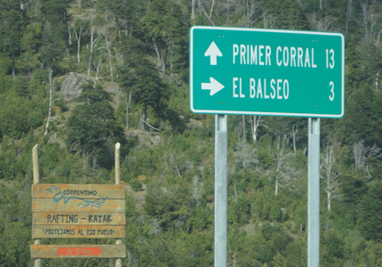
Bonito tramo al lado poniente del Río Puelo que se dirige bastante alto sobre el Río Puelo, el río se ve en algunas oportunidades, encajonado entre las cordilleras graníticas. Pasa principalmente por bosques, interrumpido por pocos claros y casas. Su trayecto es bastante marcado, y no hay mayor peligro de perderse. En la cercanía de Segundo Corral se debe cruzar el Arroyo Barrancas, pero siempre esta equipado con algunos troncos para atravesarlos sin mojarse. La distancia entre la pasarela en Primero Corral y Segundo Corral es de aprox. 12km.
This is a beautiful route tracing high above the water alonge the western side of the Puelo. At some points the river in visible between the granite mountains. The route is mostly forest with a few clearings and houses. The router direction is clear and orientation should not pose a problem. On the outskirts of Segundo Corral you will cross the barrancas stream. Although there is no bridge there are always a few trunks to walk across without getting wet. The distance between primer corral and Segundo corral is approximately 12km.
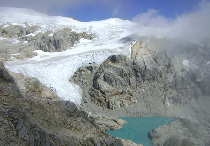
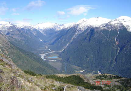
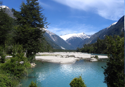
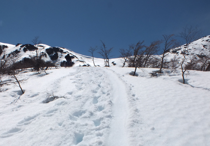
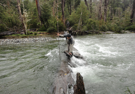
Hermoso valle, poco poblado, que se extiende por mas de 30 Km. de oeste hacia el este. Se puede entrar al valle desde ambos lado del río Ventisquero. El camino al lado de Primer Corral cuenta con una pasarela para cruzar al Estero Correntoso. Para penetrar el valle del Ventisquero es muy recomendable contar con un guía de la zona, ya que, según el estado de los senderos, en varias partes puede ser necesario cruzar su cause en vado. Debido a su régimen. Predominantemente nival el ventisquero tiene bastantes caudales en primavera y al principio de verano, lo que puede dificultar su travesía. El sendero de la ribera sur del arroyo ventisquero, se extiende por mas de 25 Km. Desde la pasarela en Primer Corral hasta el Río Universo. La parte superior del valle ventisquero es de extraordinaria belleza, se puede subir mas aun, por sendero pequeños y guiado por lugareños. Es un lugar extraordinariamente recomendado para realizar cabalgatas de varios días y trekking.
A beautiful, sparsely populated valley that extends for more than 30 kilometers from east to west. The valley is accessible from both sides of the Ventisquero River. The route next to Primer Corral has a wooden bridge that crosses over to the correntoso stream. Depending on trail conditions it may be necessary to cross Small River fords. It is highly recommended you hire a local guide to help you explore the valley. Because the glacier is fed by winter snows, there is abundant run off in the spring and summer, which can make crossings difficult. Ventisquero stream's south side trail extends for more than 25 km. from Primer Corral's wooden bridge to the Universo Rive. The higher altitude sections of the Ventisquero Valley are astoundingly beautiful, featuring blue-white glacier. Accompanied by a local guide, you may climb still higher on a variety of small trail. This is an ideal spot for several day of horseback riding.
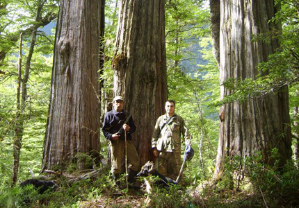
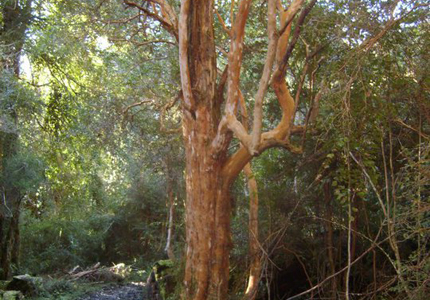
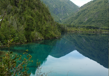
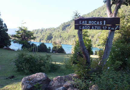
Bella caminata por un valle despoblado, con la presencia de un alerzal en su parte superior. Esta caminata que supera los 30 Km. se puede hacer en un solo día saliendo temprano, o en dos días llevando carpa. Se recomienda caminar con guía, para no perder mucho tiempo en la búsqueda del sendero. La trayectoria recomendada es: Llanada Grande - Lago Totoral - Lago Azul- Valle Huemul (CUIDADO: en el mapa IGM esta cambiado los arroyos Huemul e Igor). Al principio del valle se abren hermosas vistas hacia el Lago Azul y también hacia el Valle Alerce en la dirección opuesta. Para llegar al alerzal donde también son abundantes los mañios, cipreses de la Guaitecas y tepas hay que cruzar el río. En el trayecto hay varios campos abandonados donde se puede acampar. La vuelta pasa por el mismo sendero, con la posibilidad de volver a Llanada Grande por el medio Valle Alerce. Es preferible recorrer el camino sin caballo.
A lovely hike through a non-populated valley featuring giant Alerce trees in the higher sections. This trek is more than 30 km. long and can be done in one full day or in two days, with a tent. Hiring a guide is recommended to avoid losing time in search of the trail. The recommended route is as follows: Llanada Grande-lake Totoral- Azul lake- Huemul Valley (BE CAREFUL: the IGM map confuses the Huemul and Igor streams). At the outset of the valley there are beautiful views of Azul Lake and in the opposite direction. Alerce valley. You must cross the rive to get to the giant Alerce grove where there is also a large number of Manio, Guiateca Cypresses and Tepa trees. The same trail is used for the return, white the option of exploring the Alerce valley on the to Llanada Grande. Horses are not recommended on this route.
Sendero de aprox. 12 km. De largo que empieza en Lago Verde con varios puntos de hermosa vista y numerosas subidas y bajadas. Se debe pedir permiso porque al principio es un camino vecinal. El camino pasa por el pequeño Lago Esmeralda. Después de entrar al camino publico con dirección a Llanada Grande se dirige otro sendero hacia el este hacia el Lago Azul donde se ve una península y la Isla Nautilus.
This is a 12 kilometer trail, beginning in Lake Verde with various vista points and many uphill and downhill stretches. One should ask permission as the first part of the road is communal and passes by Esmeralda Lake. Once on the public section towards Llanada Grande, take the trail towards the east and Azul Lake where you can see the peninsula and nautilus island. The one person living there permits camping.
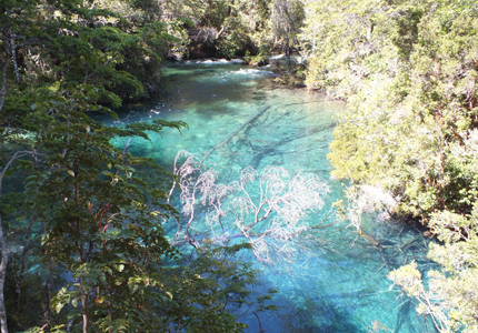
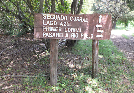
Este tramo pasa por los tres lagos más grandes de la zona. Empieza al externo sur del Lago Azul y pasa por los bosques más antiguos de la zona con inmensos troncos cubiertos con líquenes. La vegetación es muy rica en musgos, helechos, lianas y chilcos. Debido a los bosques el lago de las rocas solamente se ve en lagunas partes. Aprox. Al km11 empieza una bajada hacia el reten de donde se puede ver el Lago Inferior que se encuentra muy cerca de lago de las rocas pero aun nivel de 100 metros por debajo de este. Desde el reten camino principal baja y llega aprox. Donde se cruza el Río Puelo. El camino sigue a esta orilla del Río. y llega aprox. Al km. 18 a Segundo Corral, aldea con infraestructura básica y cancha de aterrizaje.
This trail in the three largest lakes of the region. It begins at the southernmost point of Azul lake and goes through the areas oldest forests, full. Of immense trunks in lichen. The vegetation is rich in moss, ferns, lianas, and chilcos. Through the dense forest the lake of the rocks in only visible at certain points. At about km 11 there is a downhill stretch towards the outpost where you can see inferior lake, located almost 100 meters directly below the lake of the rocks. The main route goes from the outpost to the Puelo River where you can cross the river by a hand operated raft (km.15) and then continue on. Segundo corral, a small village with basic infrastructure and a landing field, is located at kilometer 18.
Sendero sin dificultad que permite la visita de un día o de más tiempo aprovechando la posibilidad de quedarse en uno de los típicos campos del Valle Horquetas, donde los pobladores hospitalarios ofrecen camping, alojamiento y caminatas a algunas cumbres con hermosas vistas. Es posible observar la mezcla de jabalí con suinos locales. El bosque del valle esta bastante degradado debido a grandes incendios del pasado. Pasando por una laguna es posible llegar hasta el paso fronterizo esperanza, que se encuentra a una altura de tan solo 684 m.s.n.m (PASO NO HABITADO).
It's a relatively easy route that invited a visit and a stay on a typical farm in Horquetas valley. The hospitable settlers offer camping, lodging, and excursions to various peaks with beautiful vistas. Here you will encounter a mix of jabalìs and domestic pigs. The valley's forests are quite damaged due to forest fires. You many also reach the Esperanza border crossing located at only 684 meters above sea level. (THE PASS IS NOT HABILITATED).
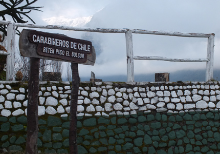
Tramo de salida de Chile por el Paso Los Hitos. Comienza en Segundo Corral por la orilla sur del Puelo y después de cruzarlo con balsa se sigue al lado norte del Lago Inferior. En el reten se deben obtener los timbres necesarios para poder salir del país. Camino rocoso con numerosas subidas y bajadas y también se deben cruzar varios esteros. En las rocas se pueden observar raspaduras que dejo la edad glaciar. Cerca de un campo abandonado (km. 13), se encuentra el limite internacional y es posible bajar hacia los hitos que se encuentran a las orillas del río que une los lagos puelo con el inferior. A parir de los hitos el camino, ahora dentro del parque nacional argentino "Lago Puelo" esta muy señalizado. Desde el camino se abre una vista muy bonita al Lago Puelo y aprox. En el Km. 19 se llega a Gendarmería Argentina. Existe la posibilidad de acampar y continuar por un camino terrestre o cruzar el lago puelo con barco. Tramo no recomendado con caballo para los principiantes en cabalgatas.
This route exits Chile through the El Bolsòn pass. Begin in Segundo corral on the south shore of the Puelo, cross the river on a raft, and continue on to the north side of lake inferior. Exit stamp your passport a the "Retèn de carabineros" or police outpost. An interesting sign there describes the different fire marks the locals use to identify animals. The trail is rocky with many uphill and downhill stretches that cross various streams. In the rock you may also observe trances and marks the glacial period left behind. The international line is located near an abandoned farm (km 13). From there one can descend to Los Hitos on the shore of the river uniting lakes Puelo and Inferior. The trail here becomes part of Argentina's lago Puelo national park. It is very well marked and offers beautiful views of Lake Puelo. The argentine border police are located at km 19. You may camp, continue on hiking, or cross the lake by boat. This route is not recommended for beginning horseback riders.
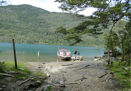
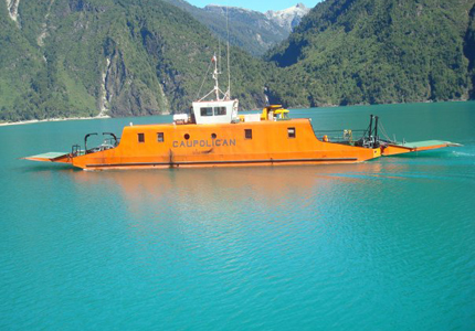
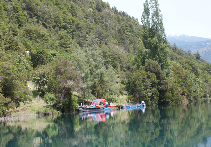
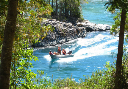
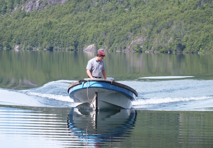
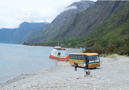
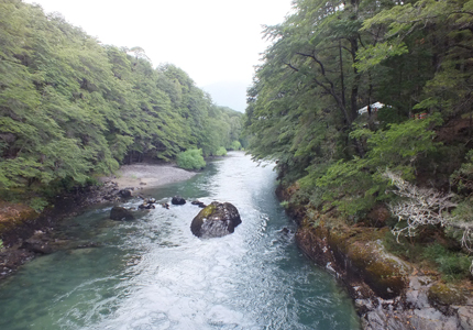
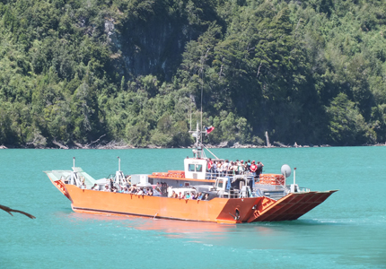
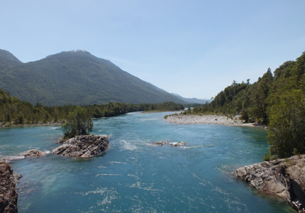
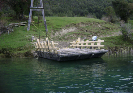
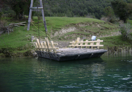
Dada la presencia de varios rápidos la navegación completa de Rió Puelo no es factible. Los tramos habilitados para la navegación son: Lago Tagua-Tagua – Santo Domingo, entre la angostura llamada "El Portón" y la pasarela de primer corral, segundo corral al Lago Puelo en Argentina, aunque entre Lago Inferior y el Lago Puelo existen unos rápidos que solamente se puede cruzar con embarcaciones especializadas. En los Lagos Azul y las Rocas es posible encontrar servicios de navegación. Para los visitantes que requieren contratar alguno de estos servicios se recomienda averiguar en terreno las diferentes opciones. En muchas partes existe la posibilidad de cruzar el río a remo con lancha de los pobladores.
It is impossible to navigate the whole of the Puelo River due to the rapids. Routes viable for boats include: Lake Tagua Tagua to Santo Domingo, the portòn narrows to primer corral's wooden bridge, Segundo corral to Puelo Lake in Argentina (nevertheless between Lake Inferior and Lake Puelo there are some rapids that can only be crossed in special crafts). In Lake Azul and las Rocas boat service is available. If you would like to hire a boat, it is recommended that you check the various options while still on land. In many areas you may be able to cross the river in towboats belonging to the local settler.